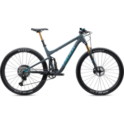
LOCAL RIDING
Mountain Biking
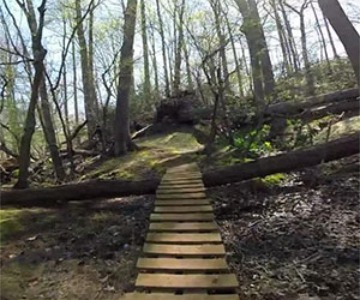
ALLAIRE STATE PARK
A local favorite. This park is big for Jersey standards, and the terrain as varied as imaginable. Allaire offers a truly diverse ride with tons of hidden treasures from cross-country trail to freeride.
Directions: From I-95, take exit 31-B and go east on Route 524. Pass the main entrance and go about a mile and a half further. Take a right onto Hospital Road. continue straight crossing the Manasquan River and park in the large gravel parking area on the right at the top of the hill.
HARTSHORNE WOODS COUNTY PARK
Well worth the drive. Both the riding and the scenery are second to none in this area. A unique and challenging ride is always guaranteed here. Challenging climbs and high-speed descending await.
Directions: From Route 35 north of Red Bank, turn east on Navesink River Road . Follow this road about 3 miles, past Brown's Dock Road. Merge with Route 8A. Turn right onto Locust Ave. and cross Claypit Creek on the new bridge. At a large stone church, bear right onto Navesink Ave. Parking for the park is about a half mile up on the right.

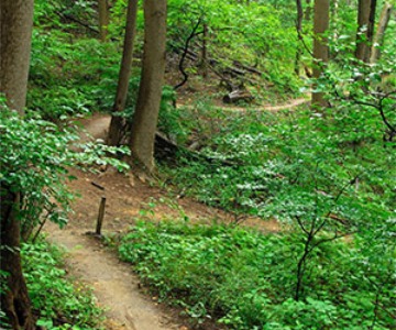
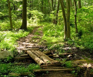
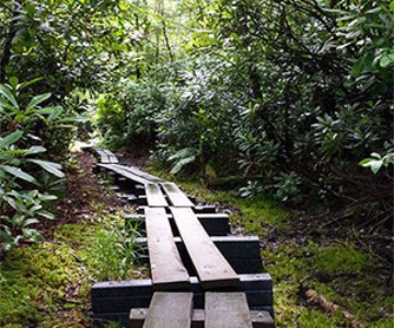
JAKE'S BRANCH COUNTY PARK
4 mile single-track trail set in the beautiful Pine Barrens can be enjoyed by all levels of riding. There are a few climbs and ladder bridges, but for the most part is flat but sinuous single-track. The 4-mile Tindley Hiking Trail [blue blaze] forms a loop around the perimeter of the park. The short Spruce Street Cut-thru [red blaze] can shorten a loop hike, or make a longer figure eight hike possible. In addition there are several miles of abandoned sand roads. Yellow blazed trail is newer and has been a favorite add on to the blue perimeter loop.
Directions: Garden State Parkway South to Exit 77, end of exit ramp, make right on to Double Trouble Road. Park is approximately 1.5 miles on the left.
CLAYTON'S COUNTY PARK
Within five minutes of Great Adventure are lightning fast trails with a very hard packed riding surface and moderate rolling hills. Not the biggest park in the area but offers a hard packed clay surface letting you maintain speed and fun throughout the park.
Directions: From Route 539 North, continue to Route 537 and turn right, follow east toward Great Adventure. Make a left on Emily's Hill Road and continue across the bridge to the stop sign. Make a right and continue straight, crossing thru another stop sign. Continue straight passing several farms until you come across the parking lot off the right side of Emily's Hill Road at the top of the hill. Park here and singletrack awaits.
BARNEGAT BRANCH RAIL TRAIL
Appropriate for beginners and all bike types. Loose, fine gravel for the length of the trail. The Barnegat Branch Trail, a rail-trail, will eventually travel 15.6 miles from Barnegat Township to Toms River Township. As of summer 2011, 5.1 miles of the trail have been completed, in two separate segments. The southern segment runs between Barnegat and Waretown, while the newly completed northern segment runs between Maryland Avenue in Berkeley and Glen Cedars Park, on the town's south side. The Barnegat Branch Trail primarily occupies a portion of the abandoned Barnegat Branch Division of the Central Railroad of New Jersey. The Barnegat trailhead at Burr Street has parking, outdoor seating areas and water fountains, as well as restrooms, a public meeting space and other amenities.
Directions: To access the southern segment in Barnegat from the Garden State Parkway, take the Wells Mill Road Exit (NJ Route 532). Proceed east to US Route 9. Turn right and proceed south to Burr Street. Turn right to the trailhead. To access the northern segment in Berkeley, parking is available along Railroad Avenue just south of the intersection with Maryland Avenue. At the Glen Cedars end, you park just south of Cedar Place.
ALLAMUCHY MOUNTAIN STATE PARK
This is full suspension territory. Very rocky with arduous climbs, technical descents and flowing single track.
Directions: From I-80, take exit 19. Follow Route 517 south and turn left on a dirt road called Deer Park Road (about 2.2 miles) and follow it to the parking area.
LEWIS MORRIS COUNTY PARK
Directions: From I-287 take exit 35 and follow route 24 west through Morristown and around the green. The park entrance is on the left approx. 3.5miles past Morristown.
MAHLON DICKERSON RESERVATION
Similar terrain to Allamuchy with less of an edge.
Directions: From I-80, take exit at route 15 north and follow it for about 5 miles to the Weldon Road exit. Take Weldon Road about 4 miles east to the Mahlon Dickerson Reservation.
RINGWOOD STATE PARK
Located near Diablo Freeride at Mountain Creek. This is probably the best, most varied, non lift-assisted riding in New Jersey. When you finish a long ride here you might want to call your mommy.
Directions: From Route 287 take exit 57 and follow signs to Ringwood State Park. Use parking lot in Skylands area off Morris Road.
WAWAYANDA STATE PARK
A varied and scenic park with incredible views of New Jerseys Ridge and Valley Province. Rocky terrain with riding for all skill levels.
Directions: From Route 23 in Newfoundland, go north on Union Valley Road through West Milford and take a left on Route 511 (Warwick Turnpike), and follow signs for Wawayanda State Park. Park next to the headquarters building.
Downhill & Free Ride
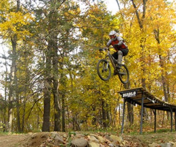
MOUNTAIN CREEK BIKE PARK
Mountain Creek Bike Park is a lift access mountain bike area. Mountain Creek offers world-class downhill and freeride trails. With beginner thru expert level dirt-jump lines, rock drops, rock-garden treachery and technical cross-country trails to keep riders of every skill set challenged and coming back for more. Don't let it's size fool you. This place is truly incredible gravity riding and as such is home to the US Open of Mountain Biking every year.
Directions: Take GSP to exit 153b and merge onto Route 3 West. Follow signs for Route 46 West and continue on Route 46 West to Route 23 North. Follow Route 23 North to Route 515 and make a right. Continue on Route 515 to Route 94 and make a left. You are now in downtown Vernon, NJ. Continue 1 mile up Route 94 and the Mountain Creek Parking lot is on your right. Suit up, amp up and get ready!
BMX Sports
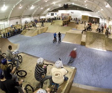
INCLINE CLUB (R.I.P.) CLOSED FOREVER 2017.
One of the best bike specific indoor skateparks in the Country. Home to more than a few of the top pro BMX riders. Small beginners section separated from a larger span of box jumps, wall rides, spines, half pipes and a lot more interesting hits. Try off times and mid week for empty sessions.
Directions: New Hampshire Avenue North to Locust Street. Make a left on Locust Street and make a quick right into the parking lot for the Incline Club. The Incline Club is located at 485 Locust Street, Lakewood, NJ 08701.
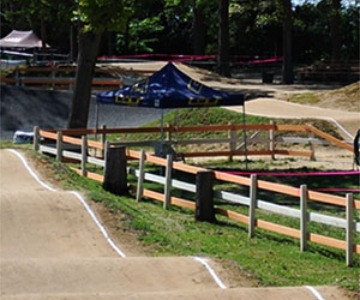
CENTRAL JERSEY BMX
A BMX track with something for everyone, Central Jersey BMX has much to offer. Whether you are an advanced rider or simply interested in checking out a BMX race, this track will be sure to serve your level of interest. New riders are always welcomed so if you would like to be introduced to the sport, head on over to the track and check it out!
Directions: Exit 99 to 195 West. 195 West to Exit 28B Route 9 North. The track is located after the second traffic light behind the bike shop.
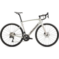
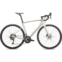
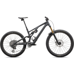
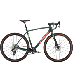
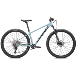
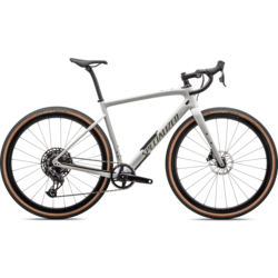
Get the Gear You Need
Shop for the perfect bike before your next ride. We’re here to answer all of your cycling related questions.
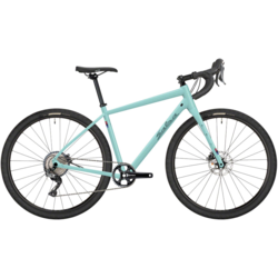
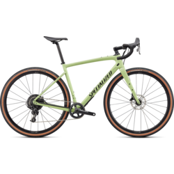

LOCAL ROAD RIDING
We may not have world class mountain biking right out of the shop door, but we are surrounded by incredibly awesome road and gravel options. We have posted 6 of the most common/shop favorite road riding loops leaving from the shop. Cue sheets are available for all of these rides on the ride calendar page.